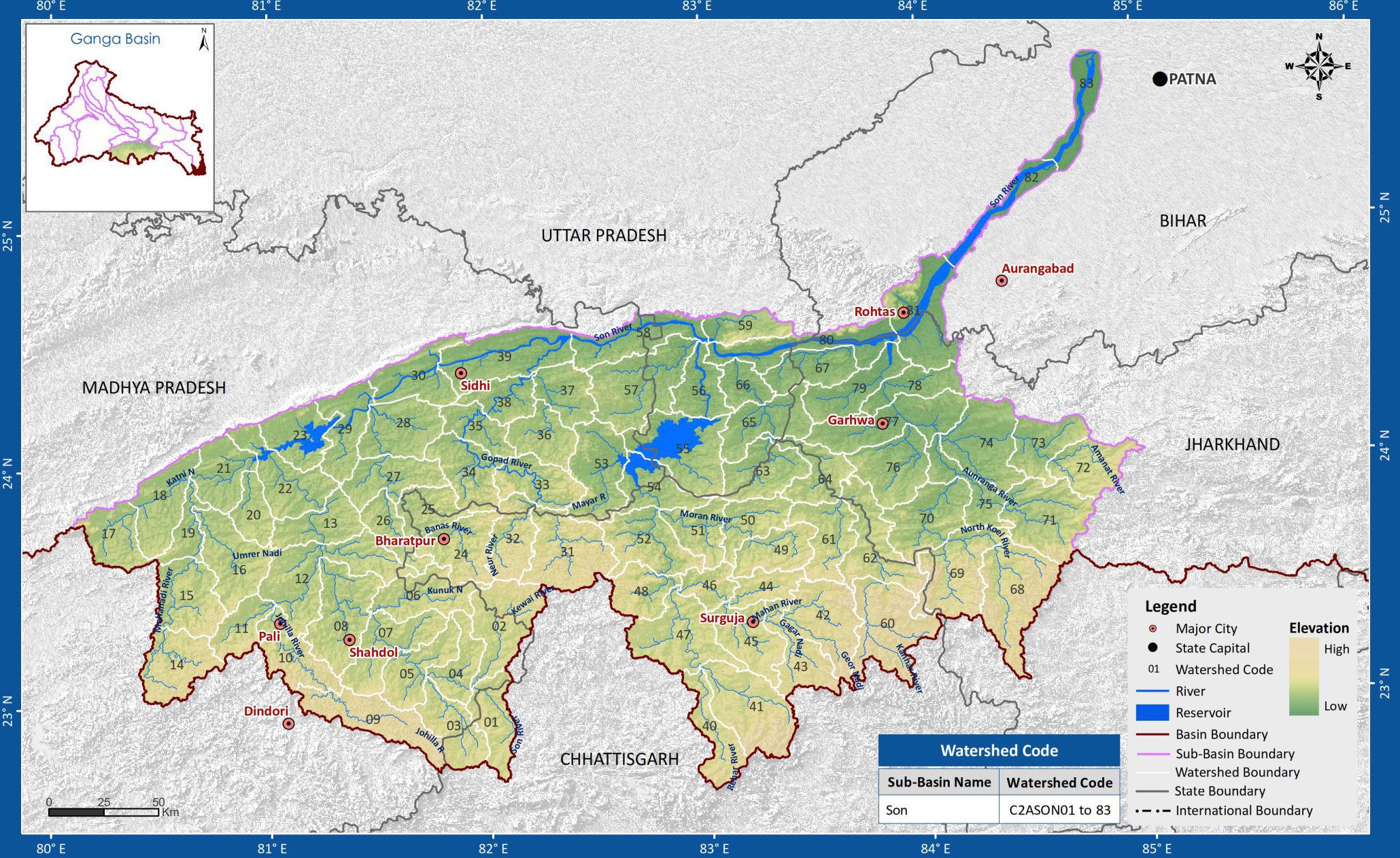
Sone Sub-basin
The geographical extent of the Sone sub-basin lies between 80° 6' to 85° 4' east longitudes and 22° 40' to 25° 42' north latitudes of the country. The main river in this sub-basin the Sone is an important right bank tributary of the Ganga river. The river originates at an elevation of 600 m at Sonbhadra in the Maikala range of hills in Madhya Pradesh. The total catchment area of the basin is 65,110 Sq.km. The important tributaries of the Sone river are the Sone and the Mahanadi, the Kanhar, the Rihand, the Gopat, the Banas, the North Koel and the Ghaghar. The Rihand dam has been constructed on the Rihand river. The total length of the river is 784 km, out of which about 500 km lies in Madhya Pradesh, 82 km in Uttar Pradesh and the remaining 202 km in Bihar. The river meets the Ganga river about 16 km upstream of Dinapur in the Patna district of Bihar. The sub-basin comprises of the states of Bihar, Chhattisgarh, Jharkhand, Madhya Pradesh and Uttar Pradesh. The sub basin map is shown below:
(Source: India-WRIS)