Banganga River
Banganga River is a prominent river in the Bharatpur district of Rajasthan. Banganga River Basin is located in the northeastern part of Rajasthan, between latitudes 26
°40' and 27°37' and longitudes 75°49' and 77°39'. It lies between the Gambhir and Banas Basins to its south-southwest, Ruparail and Sabi to its north, and the Shekhawati Basin to its west. Its eastern edge borders the Yamuna River Basin in Uttar Pradesh.
(Source :http://waterresources.rajasthan.gov.in/bbanganga.gif accessed on 220.04.2015)
Banganga River
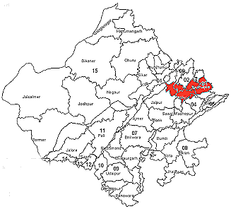
Basin extends over parts of Alwar, Jaipur, Dausa, Sawai Madhopur and
Bharatpur Districts.
The total catchment area of the Basin is 8,878 km2 according to 1:250,000
scale topographical maps published by the Survey of India.
Orographically, the western part of the Basin is marked by hilly terrain
belonging to the Aravali chain, with fairly flat valleys along the Banganga
River and its tributaries. East of the Todabhim - Mandawar chain of hills
lies an extensive alluvial plain which gently slopes eastwards, towards the
Yamuna River in Uttar Pradesh. The northeastern part of the area is also
rather flat, interspersed with moderately elevated hills.
The main urban agglomeration in Banganga River Basin is Bharatpur city
situated at the eastern edge of the Basin. The second largest urban centre
is Dausa.
Drainage
River Banganga originates in the Aravali hills, near Arnasar and Bairath in Jaipur District. It flows towards the south up to the village of Ghat, then east through partly hilly and partly plain terrain. The total length of the river is 240 km. The main tributaries are Gumti Nalla and Suri River, joining the river on its right bank, and Sanwan and Palasan Rivers, meeting the river on its left bank.
-
The Gumti Nalla basin is located between latitudes 25
Suri River: The Suri basin is located between latitudes 26°44' and 26°53' and longitudes 76°25' and 76°30'. The Suri River originates in the hills near Kanst village in Dausa District, flows north for 18 km and then northeast for 10 km before joining the main river near the village of Kailai. The catchment area of the basin is 76km2.
Sanwan River: The Sanwan basin is located between latitudes 26°59' and 27°22' and longitudes 76°16' and 76° 46'. The Sanwan River originates in the hills near Angri village in Alwar District, flows 29 km southwards, up to Sirsa Devi Bund, then 66 km eastwards before joining the main river near the village of Juthiara. The catchment area of the basin is 660km2.
Palasan River: The Palasan River originates in the hills near Rajpura village in Alwar District and joins the main river near the village of Indiana, after flowing in a south-easterly direction for 24 km and in an easterly direction for 24 km. The catchment area of the basin is 539km2 and it is located between latitudes 27°02' and 27°18' and longitudes 76°25' and 76°49'.
Rainfall
The mean annual rainfall over Banganga Basin was computed as 596 mm, of which about 95% fall during the four Monsoon months (June-September)
Existing Surface Water Projects
There is one Major irrigation project (Ramgarh, presently operating only as a water supply scheme), 10 Medium and 177 Minor irrigation projects in Banganga River Basin, as well as several small irrigation systems (covering less than 20 ha) constructed and operated by Panchayat Samities (PS).
Ongoing Surface Water Projects
One minor irrigation project with a total live storage capacity of 0.6 Mm3 is under construction in Banganga River Basin. An additional area of 248 ha. will be irrigated upon completion of this project.
Proposed Surface Water Projects
8 minor irrigation projects with a total storage capacity of 10 Mm3 have been proposed by the ID in this Basin. An additional area of some 2,700 ha will be irrigated after completion of these projects.
(Source : http://waterresources.rajasthan.gov.in/3bbanganga.htm accessed on 09.06.2016)