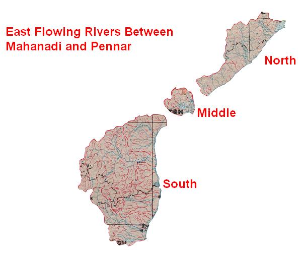
East Flowing River basin Between Mahanadi and Pennar can can be divided in three parts :
East Flowing Rivers between Mahanadi and Godavari
Turning attention to the other side of the peninsular triangle, this group covers the east-flowing rivers between Mahanadi and Godavari and extends over an area of 49,570 km2 which lies between longitudes 81°15' E to 85°30' E and latitudes 16°55' N to 20°18'N. The basin lies at the east coast of the peninsular India and covers large areas in the States of Orissa and Andhra Pradesh. The state-wise distribution of the drainage areas is shown in the following Table.
State |
Drainage Area (km2) |
|
Orissa |
25,665 |
|
Andhra Pradesh |
23,905 |
|
Total |
49,570 |
The basin of rivers in this zone bounded on the north, the west and the south by the various ranges of the Eastern Ghats and on the east by the Bay of the Bengal. The basin, which is irregular in shape has a maximum length of about 182 km in the northwest-southeast direction and a maximum width of 476 km in the northeast-southwest direction.
The basin can be divided into two major topographical divisions: the hill ranges of the Eastern Ghats and the coastal plains.
The hill ranges are well-forested. The plains extending from the eastern slopes of the Ghats slope gently towards the Bay of Bengal. The entire zone can also be divided into 13 sub-basins:
• Small streams between the Mahanadi and the Rushikulya draining into the Chilka lake;
• The Rushikulya River;• Small stream -between the Rushikulya and the Bahuda;
• The Bahuda;
• Small streams between the Bahuda and the Vamsadhara;
• The Vamsadhara;
• The Nagavali;
• Small streams between the Nagavali and the Sarada;
• The Sarada;
• The Varaha;
• The Tanadava;
• The Eluru; and
• Small stream between the Eluru and the Godavari.
East Flowing Rivers between Godavari and Krishna
These rivers flow towards east and join the Bay of Bengal between Godavari and Krishna, in total covering an area of 12,289 km2. The basin lies between longitudes 80° 30' E to 81° 45' E and latitudes 16° 10' N to 17° 30' N. This whole area falls in the State of Andhra Pradesh.
The Godavari River bounds the area on the north and the east, the Krishna River basin lies to the west and the Eastern Ghats and the Bay of Bengal on the south. The area has an irregular shape with the maximum length of 155 km in north-south direction and 125 km in east and west direction. Topographically the area can be divided in two distinct classes: the hilly area of the Eastern Ghats and the plains. There are five small basins in the area, namely,
•A small stream between Gundalkamma and Musi;
•Musi;
•Paleru;
•Manneru; and
•A small stream between the Manneru and the Pennar.
The Gundlakamma and the Manneru are the important basins.
East Flowing Rivers between Krishna and Pennar
The area occupied by the east flowing rivers between Krishna and Pennar extends over 24,649 km2 and lies between longitudes 78°45' E to 80°52' E and latitudes 14°38' N to 16°22' N. The entire area lies in state of Andhra Pradesh.
The Nallamala hills and the Velikonda range of the Eastern Ghats bound the area on the west, a ridge separates it from the Krishna basin on the north, another ridge separates it from the Pennar basin on the south, and the Bay of Bengal extends on the east. The shape of the basin is irregular and it has a maximum length of 213 km in a west-east direction and a maximum width of 186 km in the north-south direction. There are two major topographical divisions in the basin: the hilly area of the Eastern Ghats, and the plains. The plains extending from the eastern slopes of the Ghats slope gently towards the Bay of Bengal. The basin can be divided into nine sub-basins in the basin, of which the Gundlakamma and the Manneru are the more important.
Various river systems in the basin from the north to the south are: Three small streams up to the Vogarivagu; The Vogarivagu; a small stream between the Vogarivagu and the Gundlakamma; the Gundlakamma; a Small stream between the Gundlakamma and the Musi; the Musi; the Paleru; the Manneru; and a small stream between the Manneru and the Pennar.
Water Resources Projects in the Basin
A number of minor irrigation structures exist on some of these tributaries which include: Bhanjanagar reservoir; Sorada reservoir; Madhoborida diversion weir; Janivilli diversion weir; Sarisomuli diversion weirs; Ghodahado Daha Project; Ramanadi Project; Baghua Stage I Project; Dhanei Project; Jayamangal Project; and Hirdharbati projects.
Harabhanghi Irrigation Project
The Harabhanghi irrigation project is a reservoir scheme across Harabhangi River located at 19° 29' 58" N latitude and 84° 8' 12" E longitude in Ganjam district, 250 km away from Orissa State capital Bhubaneswar. The aim of the project is to supply the irrigation water through canal system to the command area lying in Ganjam district, Orissa. Ganjam district has got immense water resource so that such type of major project has been planned to cater the water requirement for irrigation.
Being an interstate river between Orissa and Andhra Pradesh, an agreement was made in 1962 between the Government of Orissa and Andhra Pradesh regarding the utilization of water of Vamsadhara basin. According to this agreement reached in the year 1962, "the yield of Vamsadhara basin is just sufficient to meet the requirement of both the states. The water of Vamsadhara basin may consequently be utilized by A.P. and Orissa on a fifty:fifty basis." The 75% of dependable water available at Gotta barrage (A.P.) is estimated to be about 3,100 MCM. Thus Orissa's share comes to 1,550 MCM. Harabhangi project is one such project in the state that utilizes its share of water in Vamsadhara basin.
The basin receives about 85% of the annual rainfall from SE monsoon during June to October. The maximum, minimum and average rainfall in this area are about 1,917 mm, 799 mm, and 1,132 mm respectively. The Live storage capacity of reservoir is 17,200 ha-m and the reservoir envisages irrigating about 9,650 ha of C.C.A. in Ganjam district.