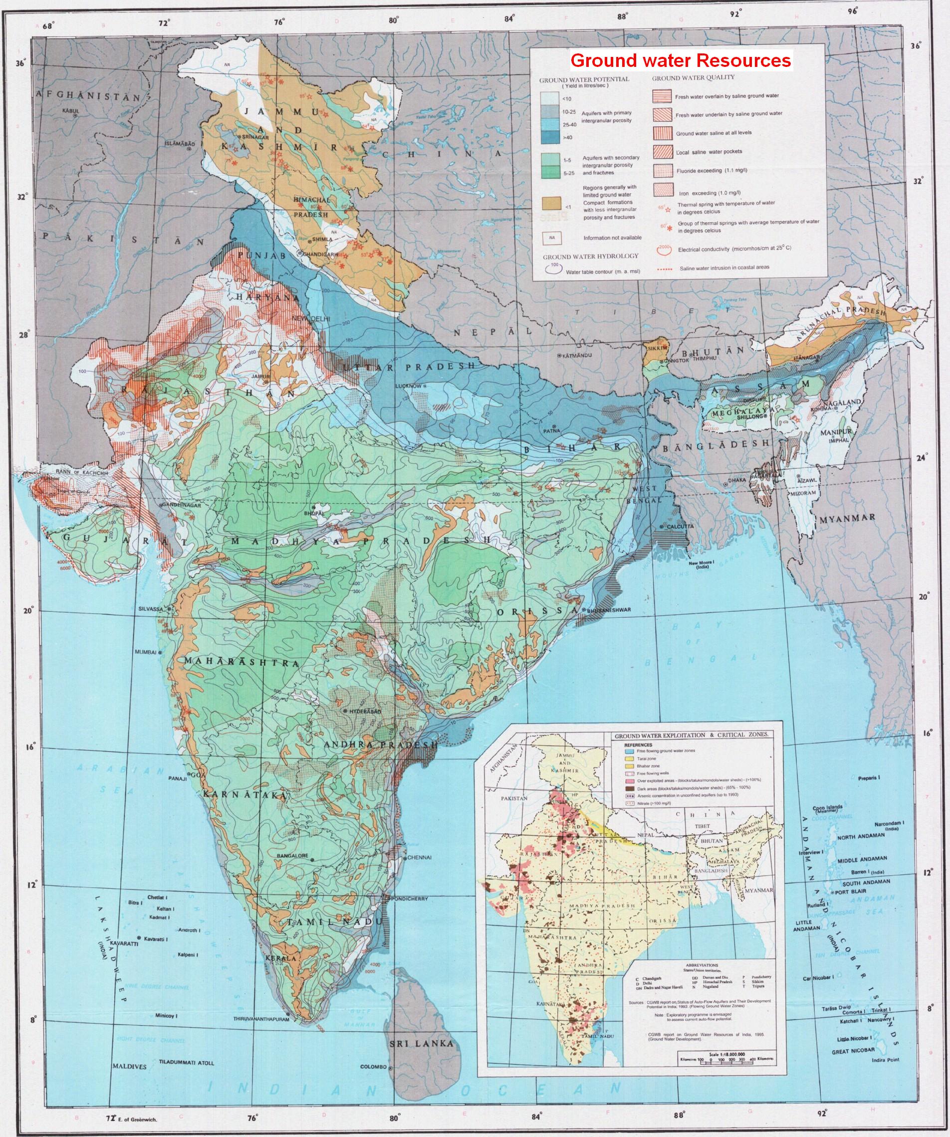
The total annual replenishable ground water resources of the Country have been reassessed as 433 Billion Cubic Meters (BCM) and the net annual ground water availability is estimated as 399 BCM. Existing gross ground water draft as on March 2004 for all uses is 231 BCM per year. The stage of ground water development is 58%. The development of ground water in different areas of the country has not been uniform. Highly intensive development of ground water in certain areas in the country has resulted in over exploitation leading to decline in the levels of ground water and sea water intrusion in coastal areas. There is a continuous growth in dark and overexploited areas in the country.
As per the latest assessment of ground water resources carried out jointly by the Central Ground Water Board (CGWB) and the States, the assessment units are categorized as 'Over exploited'/ 'Critical' and 'Semi-critical' based on the stage of ground water development and the long-term water level declining trend during the past decade (1995-2004). Out of 5723 assessment units (Blocks/ Mandals/Talukas) in the country, 839 units in various States have been categorized as 'Over exploited', i.e., the annual ground water extraction exceeds the annual replenishable resource. In addition 226 units.,11 'Critical', i.e., the stage of ground water development is above 90 per cent and within 100 per cent of annual replenishable resource. There are 550 semi-critical units, where/the stage of ground water development is between 70 per cent and 100 per cent. List of these areas is being circulated to the State Pollution Control Boards and Ministry of Environment and Forests which refer the new industries/projects falling in these areas to the Central Ground Water Authority (CGWA) for obtaining permission.
The CGWA has so far notified 43 over-exploited areas in the country for regulation of ground water development and management. For enforcement of the regulatory directions issued under Section 5 of Environment Protection Act, 1986, concerned Deputy Commissioners/ District Magistrates have been authorized to take necessary action in case of violation of directives of CGWA in the notified areas. For more effective regulation of ground water development and management, Advisory Committees under the Chairmanship of District Collector/ Deputy Commissioners with members drawn from various organizations have been constituted which will render advice in matters pertaining to regulation of ground water development and management.
The CGWA have also notified 65 over-exploited areas in various States, for registration of ground water abstraction structures, which showed a very steep decline in ground water levels and required action for regulation. The CGWA has issued directions to the Chief Secretaries of all States having over-exploited blocks to take all necessary measures to promote/ adopt artificial recharge to ground water/rain water harvesting. The CGWA has also decided to notify 747 more over-exploited areas in the country incompliant of its mandate. As per the provisions under rule 4 of the Environment (Protection) Rules, 1986, objections from the public who are likely to be effected by the directions of the CGWA are regularly sought through public notices in the newspapers. (Source : www.india.gov.in)