|
Features |
|
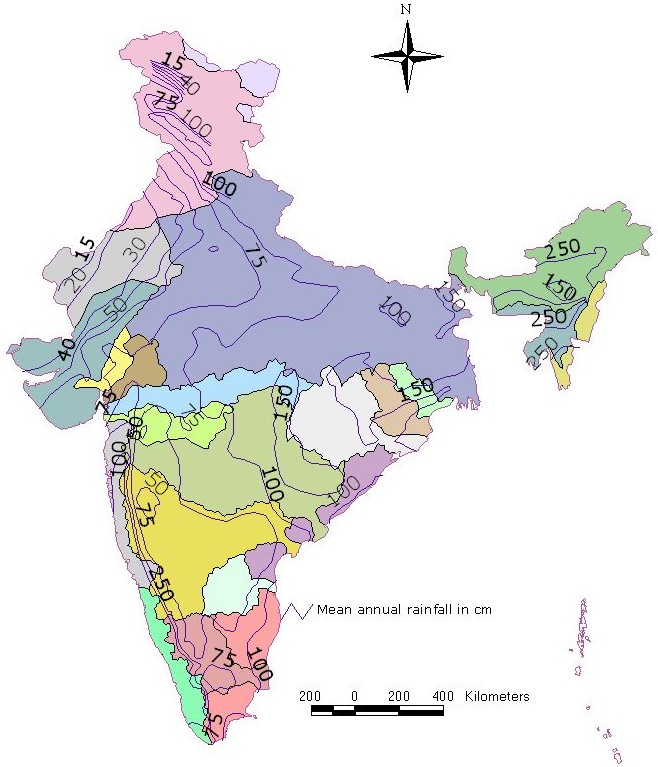
The country has a diverse landscape and a climate varying from the areas with highest rainfall such as Mawsynram near Cherrapunji (Meghalaya) to the driest parts of western Rajasthan with negligible rain and from a hot and humid southern peninsula to the snowbound Himalayan Mountains. Broadly, the climate of India is of the tropical monsoon type. It has four seasons: winter (January–February), a hot summer (March–May), rainy southwest monsoon (June–September), and post-monsoon (October–December). The climate is affected by two seasonal winds: the southwest monsoon and the northeast monsoon. The distribution of rainfall is very uneven in terms of time and space. About 72 percent of the area receives an annual rainfall of no more than 1 150 mm.
|
Distribution of Area According to Annual Rainfall
|
|||||||||||||||||||||||
| Precipitation Maps | Rainy Days Map | ||||||||||||||||||||||
| Jan-Feb | Mar-May | Jun-Sep | |||||||||||||||||||||
|
(Source : www.tropmet.res.in) Some Facts Highest Recorded Point Rainfalls (≥50cm) for One Day Duration (1875 to 1990)
|
|||||||||||||||||||||||