Model 1
Description of model
The aim of a model is, of course, precisely not to reproduce reality in all its complexity. It is rather to capture in a vivid, often formal, way what is essential to understanding some aspect of its structure or behavior…. We select, for inclusion in our model, those features of reality that we consider to be essential to our purpose… the ultimate criteria, being based on intensions and purposes as they must be, are finally determined by the individual, that is, human modeler. - Joseph Weizenbaum (1976).
Developed by the USGS. It is a block-centered finite difference code for steady-state and transient simulation of two-dimensional, quasi-three dimensional, and fully three-dimensional saturated, constant density flow problems in combinations of confined and unconfined aquifer-aquitard systems above an impermeable base.
The Soil and Water Assessment Tool (SWAT) is public domain model jointly developed by USDA Agricultural Research Service (USDA-ARS) and Texas A&MAgriLife Research. SWAT is a small watershed to river basin-scale model to simulate the quality and quantity of surface and ground water and predict the environmental impact of land use, land management practices, and climate change. It is widely used in assessing soil erosion prevention and control, non-point source pollution control and regional management in watersheds.

WEAP (Water Evaluation And Planning) is a user-friendly software tool that uses an integrated approach to water resources planning. Allocation of limited water resources between agricultural, municipal and environmental uses now requires the full integration of supply, demand, water quality and ecological considerations. WEAP aims to incorporate these issues into a practical yet robust tool for integrated water resources planning.
MIKE HYDRO Basin is a multipurpose, map-based decision support tool for integrated water resources analysis, planning and management of river basins. This model is designed for analysing water sharing issues at international, national or local river basin scale. It’s a comprehensive and simple product for investigating options and making reliable decisions.
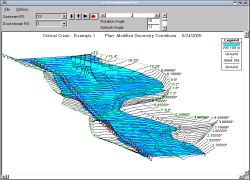
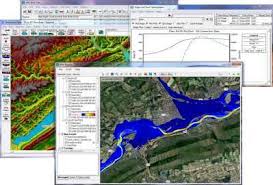
Hydrologic Engineering Center's River Analysis System (HEC-RAS) is uded to perform one-dimensional steady flow, one and two-dimensional unsteady flow calculations, sediment transport/mobile bed computations, and water temperature/water quality modeling.
One-dimensional river and stream water quality model intended to represent a well-mixed channel both vertically and laterally with steady state hydraulics, non-uniform steady flow, and diel heat budget and water-quality kinetics.
(Available in public domain)- The Hydrologic Modeling System (HEC-HMS) is designed to simulate the complete hydrologic processes of dendritic watershed systems. The software includes many traditional hydrologic analysis procedures such as event infiltration, unit hydrographs, and hydrologic routing. HEC-HMS also includes procedures necessary for continuous simulation including evapo-transpiration, snowmelt, and soil moisture accounting. Advanced capabilities are also provided for gridded runoff simulation using the linear quasi-distributed runoff transform (ModClark). Supplemental analysis tools are provided for model optimization, forecasting streamflow, depth-area reduction, assessing model uncertainty, erosion and sediment transport, and water quality. This model can be used in conjunction with other software for studies of water availability, urban drainage, flow forecasting, future urbanization impact, reservoir spillway design, flood damage reduction, floodplain regulation, and systems operation.
Download Link- http://www.hec.usace.army.mil/software/hec-hms/
(Available in public domain)- Hydrologic Engineering Center's River Analysis System (HEC-RAS) is uded to perform one-dimensional steady flow, one and two-dimensional unsteady flow calculations, sediment transport/mobile bed computations, and water temperature/water quality modeling.
(Available in public domain)- The Reservoir System Simulation (HEC-ResSim) software developed by the U.S. Army Corps of Engineers, Institute for Water Resources, Hydrologic Engineering Center is used to model reservoir operations at one or more reservoirs for a variety of operational goals and constraints. The software simulates reservoir operations for flood management, low flow augmentation and water supply for planning studies, detailed reservoir regulation plan investigations, and real-time decision support. HEC-ResSim can represent both large and small scale reservoirs and reservoir systems through a network of elements (junctions, routing reaches, diversion, reservoirs) that the user builds. The software can simulate single events or a full period-or-record using available time-steps.
Download Link- http://www.hec.usace.army.mil/software/hec-ressim/
(License based)- MIKE FLOOD is the unique toolbox for professional flood modellers. It includes a wide selection of specialised 1D and 2D flood simulation engines, enabling you to model any flood problem - whether it involves rivers, floodplains, flooding in streets, drainage networks, coastal areas, dams, levee and dike breaches, or any combination of these. The core elements in MIKE FLOOD are well-proven models, MIKE HYDRO River for rivers, MIKE URBAN for collection systems and MIKE 21 for 2D surface flow. This model is applicable at any scale from a single parking lot to regional models. Typical applications include: i) flood forecasting; ii) flood management and mitigation; iii) flood risk analysis and flood hazard mapping for industrial, residential or cultural heritage areas; iv) flood contingency planning like evacuation routes and rescue priorities planning; v) climate change assessments; vi) dam breach and flood defence failure impact studies and vii) integrated urban, river and coastal flood modeling.
Download Link- https://www.mikepoweredbydhi.com/products/mike-flood
(License based)- MIKE HYDRO Basin is a multipurpose, map-based decision support tool for integrated water resources analysis, planning and management of river basins. This model is designed for analysing water sharing issues at international, national or local river basin scale. It’s a comprehensive and simple product for investigating options and making reliable decisions. Typical applications includes: i) Multisector solution alternatives to water allocation and water shortage problems; ii) Climate change impact assessments on water resources availability and quality; iii) Exploration of conjunctive groundwater and surface water usage; iv) Optimisation of reservoir and hydropower operations; v) Evaluation and improvement of irrigation scheme performance; vi) Integrated water resources management (IWRM) studies.
Download Link- https://www.mikepoweredbydhi.com/products/mike-hydro-basin
(License based)- MIKE HYDRO River is our new generation river modelling package - successor of the world-known MIKE 11 river modelling system. MIKE HYDRO River is top quality river modelling, covering more application areas than any other river modelling package available. It enables you to model a variety of tasks related to river hydraulics, water quality, flooding, forecasting, navigation as well as catchment dynamics and runoff. Typical applications includes: i) MIKE HYDRO River is the ideal software for i) real-time flood forecasting; ii) dam break analysis; iii) reservoir optimisation including complex structure operations; iv) ecology and water quality assessments in rivers and wetlands; v) flood analysis and flood alleviation design studies; vi) water quality forecasting; vii) sediment transport and long term assessment of river morphology changes; viii) salinity intrusion in rivers and estuaries.
Download Link- https://www.mikepoweredbydhi.com/products/mike-hydro-river
(License based)- MIKE 21C is one of the most comprehensive and well established tools for simulating river bed and channel plan form development caused by changes in the hydraulic regime. Simulated processes include alluvial resistance, bank erosion as well as scouring and shoaling caused by activities such as construction and dredging, and seasonal flow fluctuations. MIKE 21C is applied in complex river dynamics with a primary focus on sediment transport and river morphology.
Download Link- https://www.mikepoweredbydhi.com/products/mike-21c
(License based)- MIKE SHE delivers truly integrated modelling of groundwater, surface water, recharge and evapotranspiration. It is the ideal software for integrated catchment hydrology, conjunctive use and management of surface water and groundwater, irrigation and drought management, wetland management and restoration, environmental river flows, floodplain management, groundwater-induced flooding, land use and climate change impacts on groundwater and surface water, nutrient fate and management and integrated mine water management.
Download Link- https://www.mikepoweredbydhi.com/products/mike-she
(Available in public domain)- The Rainfall-Runoff Modelling Toolkit (RRMT) is used for lumped modelling of the catchment(s), while the Semi-Distributed Rainfall-Runoff Modelling Toolkit (RRMT-SD) is used for the semi-distributed representation of the catchment. These tool kits were developed at Imperial College London, UK.
(Available in public domain)- United States Environmental Protection Agency (EPA's) Storm Water Management Model (SWMM) is used for single event or long-term simulations of water runoff quantity and quality in primarily urban areas. It is used throughout the world for planning, analysis, and design related to stormwater runoff, combined and sanitary sewers, and other drainage systems. SWMM was developed to help support local, state, and national stormwater management objectives to reduce runoff through infiltration and retention, and help to reduce discharges that cause impairment of our Nation’s waterbodies.
Download Link- https://www.epa.gov/water-research/storm-water-management-model-swmm
| Models | Type (Dimensions) |
Modelling Approach | Capability | Applicability | Availability | ||||||
|---|---|---|---|---|---|---|---|---|---|---|---|
| 1D | 2D | 3D | Analytical | Numerical | Saturated Zone |
Unsaturated Zone |
GW | GW+SW | Salt water Intrusion |
Open/Licensed | |
| AQESSS | Y | Y | N | Y | N | Y | N | Y | N | N | Open |
| CAPZONE | Y | Y | N | Y | N | Y | N | Y | N | N | Open |
| FEFLOW | Y | Y | Y | N | Y | Y | Y | Y | Y | Y | Licensed |
| GFLOW | Y | Y | N | Y | Y | Y | Y | Y | Y | - | Licensed |
| GMS | Y | Y | Y | Y | N | Y | N | Y | Y | Y | Open |
| GSFLOW | Y | Y | N | N | Y | Y | N | Y | Y | - | Open |
| GWM | Y | Y | Y | N | Y | Y | N | Y | - | - | Open |
| HELP | Y | Y | N | N | Y | Y | Y | Y | Y | N | Open |
| HST3D | Y | Y | Y | Y | N | Y | N | Y | - | Y | Open |
| HYDRUS | Y | Y | Y | N | Y | Y | Y | Y | - | - | Licensed |
| MOC3D | Y | Y | Y | Y | Y | Y | Y | Y | Open | ||
| MODFLOW (96, 2000 & 2005) |
Y | Y | Y | Y | Y | Y | N | Y | Y | N | Open |
| MT3D | Y | Y | Y | Y | Y | Y | N | Y | Open | ||
| ONE-D | Y | N | N | Y | N | Y | N | Y | N | N | Open |
| PHREEQC | Y | N | N | N | Y | N | - | - | - | - | Open |
| PMWIN | Y | Y | Y | Y | Y | Y | Y | Y | Y | Y | Open |
| SEAWAT | Y | Y | Y | N | Y | Y | - | Y | - | Y | Open |
| SUTRA | Y | Y | Y | Y | Y | Y | Y | Y | - | Y | Open |
| Visual MODFLOW Flex |
Y | Y | Y | Y | Y | Y | Y | Y | Y | Y | Licensed |
| VS2DI | Y | Y | Y | Y | Y | Y | Y | Y | - | - | Open |
(License based)- Developed by Haitjema Software Group. It is an efficient stepwise groundwater flow modeling system based on the analytic element method. It models steady state flow in a single heterogeneous aquifer using the Dupuit-Forchheimer assumption. It is particularly suitable for modeling regional horizontal flow and also facilitates detailed local flow modeling. GFLOW supports a MODFLOW-extract option to automatically generate MODFLOW files in a user-defined area with aquifer properties and boundary conditions provided by the GFLOW analytic element model. GFLOW also supports conjunctive surface water and groundwater modeling using stream networks with calculated base flow.
(Available in public domain)- GMS (Groundwater Modeling System) was developed by Environmental Modeling Research Laboratory or EMRL, USA. A comprehensive package which provides tools for every phase of a groundwater simulation including site characterization, model development, post-processing, calibration, and visualization. It features 2D and 3D geostatics, stratigraphic modeling and a conceptual modeling approach. It supports MODFLOW, MODPATH, MT3DMS, RT3D, FEMWATER, SEEP2D and UTEXAS.
(Available in Public domain)- Developed by the USGS. It is a block-centered finite difference code for steady-state and transient simulation of two-dimensional, quasi-three dimensional, and fully three-dimensional saturated, constant density flow problems in combinations of confined and unconfined aquifer-aquitard systems above an impermeable base. MODFLOW-2005 version is the most stable version of MODFLOW series. The family of MODFLOW-related programs now includes groundwater/surface water systems, solute transport, variable density flow (including saltwater), aquifer-system compaction and land subsidence, parameter estimation, and groundwater management. It is written in FORTRAN 77
Download Link- https://water.usgs.gov/ogw/modflow/MODFLOW.html#downloads
(License based)- It is promoted by Waterloo Hydro-geologic. The Visual MODFLOW Flex is a graphical user interface for MODFLOW groundwater simulations. It brings together industry-standard codes for groundwater flow and contaminant transport, essential analysis and calibration tools, and stunning 3D visualization capabilities in a single. With Visual MODFLOW Flex, groundwater modelers have all the tools required for addressing local to regional-scale water quality, groundwater supply, and source water protection issues.
Download Link- https://www.waterloohydrogeologic.com/visual-modflow-flex/
(License based)- Developed by DHI with user interface supports. It is a 2D/3D finite element subsurface flow system - model for density dependent groundwater flow, heat flow and contaminant transport with GIS interface. The program uses finite element analysis to solve groundwater flow equation of both saturated and unsaturated conditions as well as mass and heat transport, including fluid density effects and chemical kinetics for multi-component reaction systems.
Download Link- https://www.mikepoweredbydhi.com/download/mike-2016/feflow
(Available in Public domain)- Developed by the USGS. SUTRA is a finite-element simulation model for 2D or 3D saturated-unsaturated, fluid-density-dependent ground-water flow with energy transport or chemically-reactive single-species solute transport model. The model employs a two-dimensional hybrid finite-element and integrated finite- difference method to approximate the governing equations that describe the two interdependent processes that are simulated: (1) fluid density dependent saturated or unsaturated ground-water flow, and either (2) transport of a solute in the ground water, and (3) transport of thermal energy in the ground water and solid matrix of the aquifer.
Download Link- https://water.usgs.gov/nrp/gwsoftware/sutraprep/sutraprep.html
(Available in Public domain)- Developed by the USGS. It simulates groundwater flow and associated heat and solute transport in three dimensions. The HST3D program may be used for analysis of problems such as those related to sub-surface-waste injection, landfill leaching, saltwater intrusion, freshwater recharge and recovery, radioactive-waste disposal, hot-water geothermal systems, and subsurface energy storage. The three governing equations are coupled through the interstitial pore velocity, the dependence of the fluid density on pressure, temperature, and solute-mass fraction, and the dependence of the fluid viscosity on temperature and solute-mass fraction. The solute-transport equation is for only a single, solute species with possible linear-equilibrium sorption and linear decay. Finite-difference techniques are used to discretize the governing equations using a point-distributed grid.
Download Link- https://wwwbrr.cr.usgs.gov/projects/GW_Solute/hst/
(Available in Public domain)- Developed by the USGS. It is a modular 3-D multi-species transport model for simulation of advection, dispersion, and chemical reactions of contaminants in groundwater systems coupled with MODFLOW
Download Link- https://water.usgs.gov/ogw/mt3d-usgs/#downloads
(License based)- A software package developed by PC-Progress Engineering Software Developer of Czech Republic for simulating water, heat, and solute movement in two- and three-dimensional variably saturated media. The software package consists of a computational computer program and an interactive graphics based user interface.
Download Link- https://www.pc-progress.com/en/Default.aspx?h3d-downloads
(Available in Public domain)- USGS three-dimensional method-of-characteristics groundwater flow and transport model. The model computes changes in concentration of a single dissolved chemical constituent over time that are caused by advective transport, hydrodynamic dispersion including both mechanical dispersion and diffusion), mixing (or dilution) from fluid sources, and mathematically simple chemical reactions (including linear sorption, which is represented by a retardation factor, and decay). The model can also simulate ground-water age transport and the effects of double porosity and zero-order growth/loss.
Download Link- https://water.usgs.gov/nrp/gwsoftware/moc3d/moc3d.html
(Available in Public domain)- SEAWAT developed by the USGS is a generic MODFLOW/MT3DMS-based computer program designed to simulate three-dimensional variable-density groundwater flow coupled with multi-species solute and heat transport. SEAWAT uses the familiar structure of MODFLOW and MT3DMS. It also allows to work with many of the MODFLOW-related software programs, such as MODPATH, ZONEBUDGET, and parameter estimation programs.
((Available in Public domain)- A graphical software package for simulating fluid flow and solute or energy transport in variably saturated porous media. It allows gravity driven vertical flow out of the domain assuming a unit vertical hydraulic gradient but does not allow flow into the domain. The VS2DI software package includes three applications: VS2DTI for simulation of water and solute transport, VS2DHI for simulation of water and energy transport, and VS2POST a standalone Post processor for viewing results saved from previous simulation runs.
Download Link- https://wwwbrr.cr.usgs.gov/projects/GW_Unsat/vs2di1.2/
(Available in Public domain)- HELP (Hydrologic Evaluation of Landfill Performance) is a Hydrologic numerical model developed by the US-EPA for landfill. The model uses a water-balance approach to model evapotranspiration and drainage through soil layers. It is a quasi-two dimensional, deterministic, water-routing model for determining water balances. Groundwater Flow & Transport with Geochemical Reactions.
(Available in Public domain)- Developed by the USGS. Groundwater Management process for MODFLOW using optimization. Current Versions include GWM-2005 and GWM-VI. It uses a response-matrix approach to solve several types of linear, nonlinear, and mixed-binary linear groundwater management formulations. Each management formulation consists of a set of decision variables, an objective function, and a set of constraints
(Available in Public domain)-Developed by the USGS. It is a computer program for speciation, batch reaction, one-dimensional transport, and inverse geochemical calculations. It is a 1-D advective reaction-transport model.
Download Link- https://wwwbrr.cr.usgs.gov/projects/GWC_coupled/phreeqc/
(Available in Public domain)- Developed by the USGS. Groundwater Management process for MODFLOW using optimization. Current Versions include GWM-2005 and GWM-VI. It uses a response-matrix approach to solve several types of linear, nonlinear, and mixed-binary linear groundwater management formulations. Each management formulation consists of a set of decision variables, an objective function, and a set of constraints
(Available in Public domain)- Developed by the USGS. Several spreadsheets for the analysis of aquifer-test and slug-test data. Each spreadsheet incorporates analytical solution(s) of the partial differential equation for ground-water flow to a well for a specific type of condition or aquifer.
(Available in Public domain)- Developed by Integrated Groundwater Modeling Centre, Colorado. An analytical flow model that can be used to construct groundwater flow models of two-dimensional flow systems characterized by isotropic and homogeneous confined, leaky-confined, or unconfined flow conditions.
Download Link- http://igwmc.mines.edu/software/freeware_list.html
(Available in Public domain)- Developed by the USDA. It is a package of five analytical models of the one dimensional convective-dispersive transport equation with linear adsorption, zero-order production, and first-order decay.
Download Link- https://www.ars.usda.gov/research/software/download/?softwareid=141
(Available in Public domain)- PMWIN was originally developed to support the first official release of MODFLOW (McDonald and Harbaugh, 1988).PMWIN comes with a professional graphical user-interface, the supported models and programs and several other useful modeling tools. The graphical user-interface allows you to create and simulate models with ease and fun. It can import DXF- and raster graphics and handle models with up to 1,000 stress periods, 80 layers and 250,000 cells in each model layer.
| Models | Types (Dimensions) |
Modelling Approach |
Modelling capability |
Applicability | Availability | |||
|---|---|---|---|---|---|---|---|---|
1D |
2D |
3D |
ADE |
CSTR |
WQ parameters |
Lakes/Reservoir/Stream |
Source |
|
| AQUATOX | N | Y | N | N | Y | pH, DO, nutrients, Phytoplankton, Zooplankton, sediment and aquatic plants etc. |
Lakes and reservoirs |
Open |
| HSPF | Y | N | N | N | Y | pH, NH4, DO,BOD, temp., Nitrogen, Phosphorous, pesticides, fecal coliforms, sediment phytoplankton, and zooplankton. |
Watersheds, Streams, and Lakes |
Open |
| CE-QUAL-W2 | Y | Y | N | Y | N | Nutrients, DO,BOD, fish habitat, algae, epiphyton/periphyton, zooplankton, macrophyte, TOC, Sediment etc. |
Rivers, Estuaries, Lakes and Reservoirs |
Open |
| WASP | Y | Y | Y | Y | N | DO, temp, N(ON, NO2,NO3 NH3), P (OP, PO4),coliform, salinity, SOD, CBOD, bottom algae, silica, pesticides etc |
Rivers, Lakes, Estuaries, Coastal wetlands, and Reservoirs |
Open |
| EFDC | Y | Y | Y | Y | N | Salinity, temp. ,suspended sediment, dissolved and adsorbed contaminants, and dye tracer |
Rivers, Lakes, Reservoirs, wetlands, Estuaries |
Open |
| QUAL 2E | Y | N | N | Y | N | Temp., Chlorophyll-a Bacteria, DO, BOD, N, P, Silicon, Phytoplankton, Zooplankton, Benthic algae, uncertainty analysis |
Rivers and Streams |
Open |
| MIKE Series | Y | Y | Y | Y | N | Temp. Bacteria, DO-BOD, Nitrogen, Phosphorus Silicon, Phytoplankton, Zooplankton, Benthic algae |
Rivers, Estuaries and Tidal wetlands |
License |
| DELFT3D | N | Y | Y | Y | N | Basic WQ parameters, nutrients, Sediment transport, phytoplankton etc |
Coastal water, Lakes, River and Estuaries | Open |
| BASIN | N | N | Y | N | Y | Non-point source pollution of a watershed | Watersheds | Open |
| CE-QUAL-RIVI | Y | N | N | N | Y | Temperature, DO, CBOD,Organic-N,NH4-N, NO3-N,Orthophosphate-P,Coliform bacteria, Dissolved Iron, Algae and Macrophytes |
Rivers andstreams | Open |
(Available in public domain)- AQUATOX is a simulation model for aquatic systems. AQUATOX predicts the fate of various pollutants, such as nutrients and organic chemicals, and their effects on the ecosystem, including fish, invertebrates, and aquatic plants. This model is a valuable tool for ecologists, biologists, water quality modelers, and anyone involved in performing ecological risk assessments for aquatic ecosystems. AQUATOX was developed by USEPA in year 2003 and the latest version 3.1 was released in year 2014.
Download Link- https://www.epa.gov/ceam/aquatox-31-download-page
(Available in public domain)- CE-QUAL-W2 is a hydrodynamic water quality model in 2D (longitudinal-vertical) for rivers, estuaries, lakes, reservoirs and river basin systems. W2 models basic eutrophication processes such as temperature-nutrient-algae-dissolved oxygen-organic matter and sediment relationships. It considers longitudinal- vertical hydrodynamics and water quality in stratified and non- stratified systems, nutrients-dissolved oxygen-organic matter interactions, fish habitat, selective withdrawal from stratified reservoir outlets, hypolimneticaeration, multiple algae, epiphyton/ periphyton, zooplankton, macrophyte, CBOD, sediment diagenesis model and generic water quality groups.
(Available in public domain)- The Environmental Fluid Dynamics Code (EFDC) is a multifunctional surface water modeling system, which includes hydrodynamic, sediment-contaminant, and eutrophication components. EFDC may be applied to water bodies including rivers, lakes, reservoirs, wetlands, estuaries, and coastal ocean regions in support of environmental assessment and management and regulatory requirements. It can be used to simulate aquatic systems in one, two, and three dimensions. The model was developed by Dr. John M. Hamrick in year 1990 and subsequent support by the USEPA.
Download Link- https://www.epa.gov/ceam/environment-fluid-dynamics-code-efdc-download-page
(Available in public domain)- Hydrological Simulation Program- Fortran (HSPF) is a comprehensive package for simulation of watershed hydrology and water quality for both conventional and toxic organic pollutants. HSPF incorporates watershed-scale ARM and NPS models into a basin-scale analysis framework that includes fate and transport in one dimensional stream channels. The model allows the integrated simulation of land and soil contaminant runoff processes with in-stream hydraulic and sediment-chemical interactions. The result of this simulation is a time history of the runoff flow rate, sediment load, and nutrient and pesticide concentrations, along with a time history of water quantity and quality at any point in a watershed. HSPF simulates three sediment types (sand, silt, and clay) in addition to a single organic chemical and transformation product of that chemical. The model was developed by US EPA in year 1997
Download Link- https://www.epa.gov/ceam/basins-download-and-installation
(Available in public domain)- The Water Quality Analysis Simulation Program (WASP) is a dynamic compartment-modeling program for aquatic systems, including both the water column and the underlying benthos. WASP allows the user to investigate one, two and three dimensional systems, and a variety of pollutant types. The model is capable of handling multiple pollutant types and it has been widely applied in the development of Total Maximum Daily Loads (TMDL). WASP has capabilities of linking with hydrodynamic and watershed models which allows for multi-year analysis under varying meteorological and environmental conditions.
(Available in public domain)- Delft3D is a three dimensional model suite to investigate hydrodynamics, sediment transport and morphology and water quality for fluvial, estuarine and coastal environments. The FLOW module is the heart of Delft3D and is a multi-dimensional (2D or 3D) hydrodynamic (and transport) simulation programme which calculates non-steady flow and transport phenomena resulting from tidal and meteorological forcing on a curvilinear, boundary fitted grid or sperical coordinates. The model was developed by Deltares, Netherland
(Available in Public domain)- Better Assessment Science Integrating Point and Nonpoint Sources (BASINS) is a multipurpose environmental analysis system designed to help regional, state, and local agencies perform watershed- and water quality-based studies. It was developed by the U.S. Environmental Protection Agency to assist in watershed management and TMDL development by integrating environmental data, analysis tools, and watershed and water quality models. A geographic information system (GIS) provides the integrating framework for BASINS. GIS organizes spatial information so it can be displayed as maps, tables, or graphics. GIS allows the user to analyze landscape information and display relationships among data. Through the use of GIS, BASINS has the flexibility to display and integrate a wide range of information (e.g., land use, point source discharges, and water supply withdrawals) at a scale chosen by the user.
Download Link- https://www.epa.gov/ceam/basins-download-and-installation
(Available in Public domain)- CE-QUAL-RIV1 is a one-dimensional hydrodynamic water quality model. CE-QUAL-RIV1 consists of two parts, a hydrodynamic code (RIV1H) and a water quality code (RIV1Q). The hydrodynamic code is applied first to predict water transport and its results are written to a file, which is then read by the quality model. It can be used to predict one-dimensional hydraulic and water quality variations in streams and rivers with highly unsteady flows, although it can also be used for prediction under steady flow conditions. RIV1H predicts flows, depths, velocities, water surface elevations, and other hydraulic characteristics. The hydrodynamic model solves the St. Venant equations as the governing flow equations using the widely accepted four-point implicit finite difference numerical scheme. RIV1Q can predict variations in each of 12 state variables: temperature, carbonaceous biochemical oxygen demand (CBOD), organic nitrogen, ammonia nitrogen, nitrate + nitrite nitrogen, dissolved oxygen, organic phosphorus, dissolved phosphates, algae, dissolved iron, dissolved manganese, and coliform bacteria. In addition, the impacts of macrophytes can be simulated. The model was developed by US Army Engineers Waterways Experiment Stations in year 1990.
Download Link- http://www.ifh.uni-karlsruhe.de/lehre/envflu_III/Lectures/riv1.htm
(Open Source) Global Climate Models (GCMs) are based on well-established physical principles and have been demonstrated to reproduce observed features of recent climate and past climate changes. Global climate model simulations used for the projections come from the international Coupled Model Inter-comparison Project Phase 5 (CMIP5)
| CMIP5 Model ID |
Institute and Country of Origin |
Ocean horizontal resolution (°lat x°lon) |
Atmosphere horizontal resolution (°lat x °lon) |
Atmosphere Eq. resolution |
|
|---|---|---|---|---|---|
| Latitude (Km) |
Longitude (Km) |
||||
ACCESS-1.0 |
CSIRO-BOM, Australia |
1.0×1.0 |
1.9×1.2 |
210 |
130 |
BCC-CSM1-1-M |
BCC, CMA, China |
1.0×1.0 |
1.1×1.1 |
120 |
120 |
CanCM4 |
CCCMA, Canada |
1.4×0.9 |
2.8×2.8 |
310 |
310 |
CCSM4 |
NCAR, USA |
1.1×0.6 |
1.2×0.9 |
130 |
100 |
CMCC-CESM |
CMCC, Italy |
2.0×1.9 |
3.7×3.7 |
410 |
410 |
CNRM-CM5 |
CNRM-CERFACS, France |
1.0×0.8 |
1.4×1.4 |
155 |
155 |
CSIRO-Mk3-6-0 |
CSIRO-QCCCE, Australia |
1.9×0.9 |
1.9×1.9 |
210 |
210 |
EC-EARTH |
EC-EARTH, Europe |
1.0×0.8 |
1.1×1.1 |
120 |
120 |
GFDL-CM3 |
NOAA, GFDL, USA |
1.0×1.0 |
2.5×2.0 |
275 |
220 |
HadCM3 |
MOHC, UK |
1.2×1.2 |
3.7×2.5 |
410 |
280 |
HadGEM2-AO |
NIMR-KMA, Korea |
1.0×1.0 |
1.9×1.2 |
210 |
130 |
HadGEM2-CC |
MOHC, UK |
1.0×1.0 |
1.9×1.2 |
210 |
130 |
INMCM4 |
INM, Russia |
0.8×0.4 |
2.0×1.5 |
220 |
165 |
IPSL-CM5A-LR |
IPSL, France |
2.0×1.9 |
3.7×1.9 |
410 |
210 |
MIROC4h |
JAMSTEC, Japan |
0.3×0.2 |
0.56×0.56 |
60 |
60 |
MPI-ESM-LR |
MPI-N, Germany |
1.5×1.5 |
1.9×1.9 |
210 |
210 |
MRI-CGCM3 |
MRI, Japan |
1.0×0.5 |
1.1×1.1 |
120 |
120 |
NorESM1-M |
NCC, Norway |
1.1×0.6 |
2.5×1.9 |
275 |
210 |
(Available in public domain)- A key limitation of Global Climate Models (GCMs) is the fairly coarse horizontal resolution. For the practical planning of local issues such as water resources or flood defences, countries require information on a much more local scale than GCMs are able to provide. Regional models provide one solution to this problem. In Table below, List of CMIP5 GCMs that have been used to provide boundary conditions for the RCA4 runs. The rightmost column indicates which RCP scenarios that have been run (2 – RCP4.5 and 8.5, 3 – RCP 2.6, 4.5 and 8.5).
| Modelling centre | Model name | References | TCR (°C) |
RCP |
|---|---|---|---|---|
| CanadianCentre for Climate Modelling and Analysis |
CanESM2 | Chylek et al. (2011) | 2.4 | 2 |
| Centre, National de Recherches Météorologiques/Centre Européen de Recherche et, Formation Avancée en Calcul Scientifique | CNRM-CM5 | Voldoire et al. (2012) | 2.1 | 2 |
| EC-EARTH consortium | EC-EARTH | Hazeleger et al. (2010) | 2.0 | 3 |
| NOAA, Geophysical Fluid Dynamics Laboratory | GFDL-ESM2M | Dunne et al. (2012) | 1.3 | 2 |
| Met, Office Hadley Centre | HadGEM2-ES | Collins et al. (2011) | 2.5 | 3 |
| Institut, Pierre-Simon Laplace | IPSL-CM5A-MR | Dufresne et al. (2013) | 2.0 | 2 |
| Atmosphere and Ocean Research Institute (The University of Tokyo), National Institute for Environmental Studies and Japan Agency for Marine-Earth Science and Technology | MIROC5 | Watanabe et al. (2011) | 1.5 | 2 |
| Max Planck Institute for Meteorology | MPI-ESM-LR | Popke et al. (2013) | 2.0 | 3 |
| Norwegian Climate Centre | NorESM1-M | Bentsen et al. (2013) | 1.4 | 2 |
Download Link - ttps://www.ncbi.nlm.nih.gov/pmc/articles/PMC5351818/
(Available in public domain)- The Statistical Downscaling Model (SDSM) is a decision support tool for assessing local climate change impacts using a robust statistical downscaling technique. It is a hybrid of a stochastic weather generator and regression-based downscaling methods and facilitates the rapid development of multiple, low-cost, single-site scenarios of daily surface weather variables under current and future climate forcing. SDSM is designed to help users identify those large-scale climate variables (the predictors), which explain most of the variability in the climate (the predictand) at a particular site, and statistical models are then built based on this information. Statistical models are built using daily observed data – local climate data for a specific location for the predictand and larger-scale NCEP data for the predictors – and these models are then used with GCM-derived predictors to obtain daily weather data at the site in question for a future time period.
Download Link- http://co-public.lboro.ac.uk/cocwd/SDSM/software.html(SDSM)
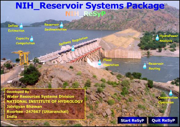
ReSyP_NIH
National Institue of Hydrology, Roorkee