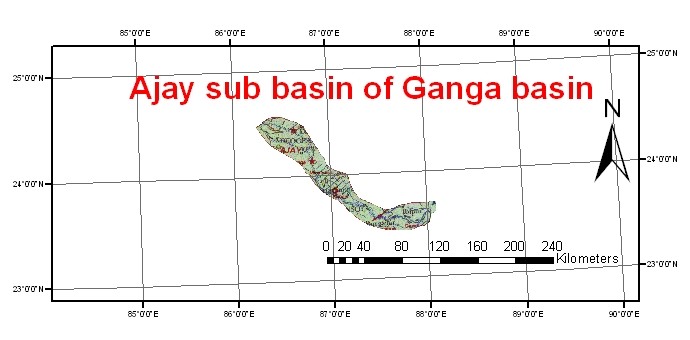
The catchment of the Ajay River spreads between latitudes 23° 25’N and 24° 35’N and longitudes 86° 15’E and 88 15’E. The Ajay River system originates in the low hills near Deoghar in the Santhal Pargana District of Jhakhand and flows in a south-easterly direction passing through the Monghyr District and Birbhum and Burdwan Districts of West Bengal. Ultimately the river falls into the Bhagirathi River at Katwa about 216 km above Calcutta. The Ajay River system lies between the Mayurakshi on the north and Damodar and the Banka/Khari River system on the south. The Ajay River traverses a total length of 299 km, 24 km being in Monghyr, 102 km in District Santhal Pargana, 22 km along the boundary of Santhal Pargana and Burdwan, 115 km along the boundary between Singhbhum and Burdwan and the rest of the total length falls in the Burdwan district of West Bengal. It meets the Bhagirathi near Katwa. The river has a catchment area of 6,050 sq. km. The various tributaries of the Ajay River are Darua, Pathro, Jainti, Hinglo, Tumuni, Kane, Kanur and Kundur.