Hydrology and Water Resources Information System for India  

Organisations

National Water Policy

Constitutional Provisions

Treaties and Tribunal Awards

Vedic Hydrology

Mythologies

On-line ET Computations

Fundamentals On-line


Water Resources Systems Division
National Institute of Hydrology Jalvigyan Bhawan, Roorkee - 247 667, India

email : deepa.nihr@gov.in
Phone : 01332 249206

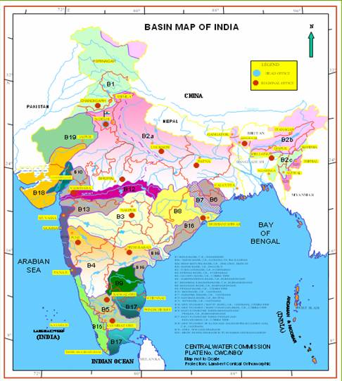
Click any basin on the map to get the related information

Barak Basin Map Brahmaputra Basin Map Brahmani & Baitarni Basin Map Cauvery Basin Map Ganga Basin Map Godavari Basin Map Indus Basin Map Krishna Basin Map Mahanadi Basin Map Mahi Basin Map Narmada Basin Map Pennar Basin Map Sabarmati Basin Map Subernarekha Basin Map Tapi Basin Map West Flowing Rivers from Tapi to Tadri West Flowing Rivers from Tadri to Kanyakumari West Flowing Rivers of Kuch, Saurashtra including Luni East Flowing Rivers Between Pennar and Kanyakumari(North) East Flowing Rivers Between Pennar and Kanyakumari(South) East Flowing Rivers Between Mahanadi and Pennar(North) East Flowing Rivers Between Mahanadi and Pennar(Middle) East Flowing Rivers Between Mahanadi and Pennar(South) Area of Inland Drainage in Rajasthan Desert Minor River Basins Draining in to Bangladesh and Myanmar(North) Minor River Basins Draining in to Bangladesh and Myanmar(South)

Note: For international / state boundaries and coastline, authoritative Survey of India maps may be referred to

                 Disclaimer: The data and information provided has been collected from various sources. They do not necessarily reflect the views of the National Institute of Hydrology.