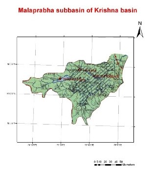
Malprabha is a right bank tributary of Krishna River. The Malprabha catchment lies between North latitudes 15° 00' and 16° 12' and east longitudes 74° 14' and 76° 05'. The Malprabha River originates from the Chorla Ghats, a section of the Western Ghats, at an elevation of about 792m about 35m south-west of Belgaum District of Karnataka. The river flows east and north-west and joins Krishna at Kapila Sangam in the Bijapur District at an elevation of about 488 m. Malprabha traverses a length of 306 km before meeting the Krishna River. The Bennihala and the Hirehalla are the principal tributaries of the river Malprabha. The total catchment area of the Malprabha including its tributaries is 11,549 sq. km, which lies wholly in the State of Karnataka.
It flows for a distance of 304 km and joins the Krishna river at an altitude of 488 meters near Kudal Sangam in Bagalkot district in Karnataka It also flows through Dharwar District. Hubli city gets the drinking water from this reservoir. The Navilateertha Dam is constructed near Munavalli in Belgaum District with a storage capacity of 1.07 km³. It irrigates more than 2,000 square kilometres of land. This reservoir is called Renukasagar.
Characteristics of the sub-basin with available runoff data
|
Code |
K4 | |
| Length (km) | 306 | |
| Area (km2) | 11,549 | |
| Total Population 2001 (millions) | 2.25 | |
| Population Density 2001 (persons/km2) | 172 | |
| Annual Rainfall Runoff (P) | (mm) | 528 |
| (km3) | 7.8 | |
| Annual Runoff (Q) (km3) | 1.6 | |
| Runoff Coefficient (Q : P) | Observed | 0.20 |
| Predicted | 0.11 | |
| Curve | LM | |
| Potential Evaporation Ep (mm/yr) | 1,468 | |
| Aridity Index (Ep/P) | 2.8 |
The catchment area for the sub-basins is the area between the gauging station and the nearest upstream gauging stations, and does not include the entire catchment area.(Ref : Closing of the Krishna Basin: Irrigation, Streamflow Depletion and Macroscale Hydrology, Research Report 111. IWMI)