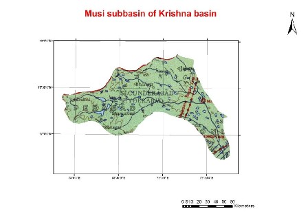
The Musi River is a major left bank tributary of Krishna, having its origin in the hills of Anathagiri near Vikarabad, Rangareddy District, A.P. It flows through Hyderabad city and runs mostly west to east until the Aleru River joins it. Flowing southwards, it meets the Krishna River near Wazirabad at an elevation of about 61 m. When it confluences with Krishna river, Musi River has already flown for 267 km.
The river has a rocky and very steep fall. It brings very heavy and sudden floods during the monsoon. During the year 1908, Musi swelled up in high floods and submerged a major portion of Hyderabad city and many villages on its banks, and caused severer damages to the property and life. Immediately after this disaster, the problem of controlling flood received the attention of Government of Hyderabad. Consequently two major reservoirs Himayatsagar and Osmansagar were constructed on the two branches of river Musi called Easa and Musa (Musi). The storages of these two reservoirs are exclusively being utilized for water supply to the twin cities of Hyderabad and Secunderabad. In recent years also, the city of Hyderabad.
Characteristics of the sub-basin with available runoff data catchment area
|
Code |
K10 | |
| Length (km) | 267 | |
| Area (km2) | 11,212 | |
| Total Population 2001 (millions) | 9.11 | |
| Population Density 2001 (persons/km2) | 641 | |
| Annual Rainfall Runoff (P) | (mm) | 669 |
| (km3) | 8.4 | |
| Annual Runoff (Q) (km3) | 1.3 | |
| Runoff Coefficient (Q : P) | Observed | 0.16 |
| Predicted | 0.14 | |
| Curve | BZ | |
| Potential Evaporation Ep (mm/yr) | 1,512 | |
| Aridity Index (Ep/P) | 2.3 |
The catchment area for the sub-basins is the area between the gauging station
and the nearest upstream gauging stations, and does not include the entire
catchment area.
(Ref : Closing of
the Krishna Basin: Irrigation, Streamflow Depletion and Macroscale
Hydrology,
Research Report 111. IWMI)