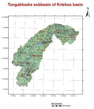
The Tungabhadra River is a sacred river in southern India that flows through the state of Karnataka to Andhra Pradesh. It is formed by the confluence of two rivers, the Tunga River and the Bhadra River, which flow down the eastern slope of the Western Ghats in the state of Karnataka at an altitude of about 1,196 m.
More than one hundred, tributaries, streams, creeks, rivulets and the like contribute to each of these two rivers. The journey of Thunga and the Bhadra is 147 km and 171 km respectively, till they join at Kudali, at an elevation of about 610 metres near Holehonnur, about 15 km from Shimoga; areca granary of the country. Thungabhadra meanders through the plains to a disitance of 531 km and mingles with the Krishna at Gondimalla, near the famous Alampur in Mahaboobnagar District of Andhra Pradesh. Varada flowing through Shimoga, Uttara Kannada and Haveri Districts and Hagari in Chitradurga and Bellary Districts in Karnataka and Handri in Kurnool distriict of A.P. are the main tributaries of the Tungabhadra. Many rivulets and streams join these tributaries.
Dams
About 15 km
downstream from Shimoga at Gajanur across the River Tunga a dam is
constructed. At Lakkavalli about 15 km upstream of Bhadravati across the
Bhadra a dam is constructed. Both are multipurpose dams and irrigate lands
in Shimoga, Chikkamagalur, Davanagere and Haveri.
TungaBhadra dam is constructed across river Tungabhadra, a tributary of River Krishna near the town of Hosapete in Karnataka. It is considered as a multipurpose dam or project. Its storage capacity is 135 Tmcft. Owing to siltation the capacity has been reduced by about 30 Tmcft. If there is seasonal and late rains, the dam distributes the estimated quantity of 235 Tmcft. The dam is filled as when the water is let into the canals during the rainy season.
At Sunkesula, about 25 km upstream from Kurnool a barrage was constructed at about 1860 for irrigation for Kurnool and Kadapa Districts, carrying water through the renowned K.C.Canal. Recently the barrage is replaced by the Kotla Vijayabhaskara Reddy Project- a permanent dam. It impounds about 15,000,000,000 cubic feet (0.42 km3) of water and irrigates about 300,000 acres (1,200 km2) of land in Kurnool and Kadapa districts.
Problems
Industrial pollution
has damaged the Tungabhadra river. Industry and mining on its banks in the
Chikkamagalur, Shimoga, Davangere, Haveri, Bellary, Koppal and Raichcur
Districts of Karnataka and Kurnool and Mahaboobnagar in Andhra Pradesh
(almost all the districts along the course of the river) generate enormous
amounts of effluents. Nearly three crores of litres of effluents were being
released to the Tunga from [Shimoga] every year. As such it is one of the
most polluted rivers in the country.
Downriver from the industries, the water has turned dark brown and has a pungent odour. Altogether, the Tungabhadra River pollution has affected 1,000,000 people in the sub-basin as most villages used the river water, previously obtained through the ancient tank system, for drinking, bathing, irrigating crops, fishing and livestock water. The livelihood of village fishermen has been harmed by regular fish kills that have exhausted Tungabhadra's fisheries.
Characteristics of the sub-basin with available runoff data
|
Code |
K8 | |
| Length (km) | 531 | |
| Area (km2) | 47,827 | |
| Total Population 2001 (millions) | 7.17 | |
| Population Density 2001 (persons/km2) | 157 | |
| Annual Rainfall Runoff (P) | (mm) | 668 |
| (km3) | 42.3 | |
| Annual Runoff (Q) (km3) | 12.2 | |
| Runoff Coefficient (Q : P) | Observed | 0.29 |
| Predicted | 0.14 | |
| Curve | BZ | |
| Potential Evaporation Ep (mm/yr) | 1,446 | |
| Aridity Index (Ep/P) | 2.2 |
The catchment area for the sub-basins is the area between the gauging station and the nearest upstream gauging stations, and does not include the entire catchment area. (Ref : Closing of the Krishna Basin: Irrigation, Streamflow Depletion and Macroscale Hydrology, Research Report 111. IWMI)
Change in rainfall, runoff, and runoff coefficients for two time-periods, 1971-1974 and 1996-2001
| Station |
Area (km2) |
Rainfall (mm) |
Runoff (mm) |
Rainfall: Runoff |
Change in Runoff km3 |
|||
| 71-74 | 96-01 | 71-74 | 96-01 | 71-74 | 96-01 | |||
|
Bawapuram |
67,180 | 730 | 792 | 71 | 71 | 0.10 | 0.09 |
0 |
The areas include the whole catchment area above the gauging station