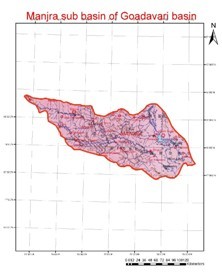
The Manjara River is one of the major tributaries of Godavari, which originates in the Balaghat Range of hills in the Bhir district of Maharashtra at an altitude of about 823 m. The river flows in a general east and south easterly direction for 512 km through the Osmanabad district of Maharashtra, the Bidar district of Mysore and the Medak district of Andhra Pradesh before changing its direction Northwards near Sanga Reddipet. After flowing for 75 km further, it enters the Nizamabad district of Andhra Pradesh and from 102 km lower down, it forms the boundary between Maharashtra and Andhra Pradesh. The total length of the river from the source to its confluence with the Godavari at an altitude of 323 m is about 724 km. The principal tributaries of the Manjara River are the Tirna, the Karanga, the Halai, the Lendi and the Maner. The catchment area of the Manjra River including its tributaries is 30,844 km2 lying in a zone which gets about 635 mm of rain annually.