|
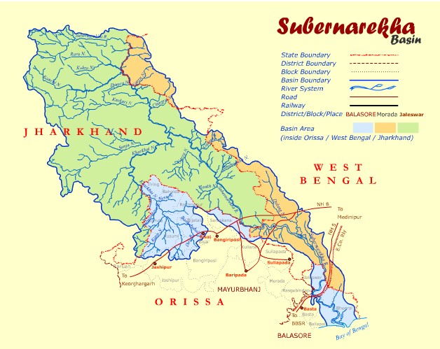
The Subernarekha River
originates near Nagri village (Ranchi district) in the
Chhotanagpur plateau of Jharkhand State at an elevation of
about 610 m at latitude 23° 18' N and longitude 85° 11' E.
Subernarekha literally means golden line. According
to legends, in ancient times, gold was being extracted in
the river's bed close to its origination point near Piska
village, close to Ranchi. Before falling in the Bay of
Bengal, the river flows through Ranchi and Singhbhum
districts of Jharkhand, Midnapore district of West Bengal
and Balasore district of Orissa. Subernarekha River flows
for a total length of 395 km. Out of this, 269 km lies in
Bihar, 64 km in West Bengal, and 62 km in Orissa. The
Subernarekha basin covers an area of 19,300 km2.
This area is nearly 0.6% of the total national river basin
area and yields 0.4% of the country's total surface water
resources. With regards to statewise distribution,
Subernarekha drains an area of 14,600 km2 in
Jharkhand (75.6% of total catchment area), 2,500 km2
(12.9%) in Orissa and 2,200 km2 (11.5%) in West
Bengal. Its important tributaries are the Kanchi, Karkari
and Kharkai.
|